

I can’t claim any credit for thinking of this. When son Ben came to stay at Christmas 2008 he was teaching himself to knit cables with the intention of knitting a Cable Tube Map.
There’s nothing like jumping in at the deep end! This was only the third or fourth thing he had ever knitted (if you ignore the knitting when he was about six years old). I don’t think he even knew how to purl when he started this. Not only was he using cables, the whole thing was offset by 22.5 degrees. The designing was complex but he has been involved with several Woolly Thoughts designs in the past so being unconventional just seems normal.
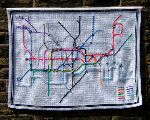
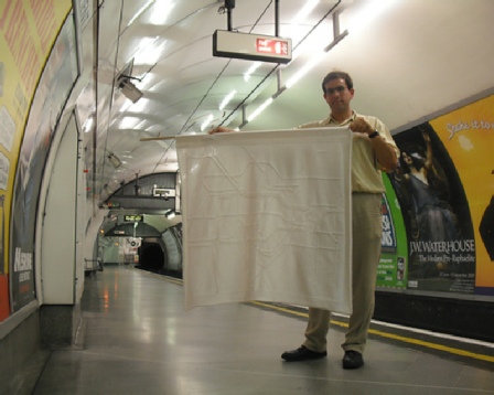
I loved the idea but cables aren’t my thing so I set about my own interpretation of the map.
I made the filet crochet background grid first. It was very boring but I love doing things on grids like this as it all takes shape very quickly once the background is ready. The River Thames was filled in first using surface crochet. The lines were added next and then the remaining background was filled in with white.
The interchanges proved to be a bit of a problem. I tried to add crochet shapes,
then tried embroidery but both looked messy. I eventually settled for using buttons.
They gave nice round circles but are not an accurate representation as many of the
interchanges on the map are drawn with lines linking part circles. This is now only
suitable as a wall-
You can see some progress photos on the Going Underground page on the main Woolly Thoughts site.
If I was starting this again, there are things I would do differently but I am still happy with the outcome.
This is what Ben wrote about his map:
This is an attempt at producing a version of the London Underground map in cable knitting.
The London Underground map used today is an adaptation of a map produced in 1931 by Harry Beck, which showed the topology of the network but not the true distances or directions between stations. Since then, several new Underground lines have been constructed. The map has been altered many times but retains its original feel. The version of the map which I am using dates from 2007, before Transport for London took over operations of some railway lines from Silverlink and incorporated them into the map.
While the tube map is very familiar in full colour, I was interested to see how recognisable it would be when knitted entirely in white, with cables for the tracks.
The lines on the map all run vertically, horizontally, or at 45°. Because I’m not aware of any way of making cables run parallel to the rows of knitting, the background of this blanket had to be knitted with rows at 22.5°. The direction of the rows can be seen to the right of the centre, where there is a band of slightly dirty yarn. The blanket has a thick border which, I hope, will help to show which way the design is meant to be oriented.
(The photos referred to can be seen on Cable Tube Map page on the main Woolly Thoughts site.)
Each cable moves across either by one stitch every third row or by two stitches every row. To enable cables to travel across the background at two stitches per row, I have had to make their stitches, and the stitches which pass behind them, unusually loose. The only problem seems to arise where a line heading South turns to head South East. In the direction in which the blanket is knitted, this feature involves two new cables appearing and rapidly moving apart, which causes a bit of distortion and the appearance of a large hole behind them.
Relative to the size of the map, my lines are thicker than on a normal Underground map so in places where several lines run alongside one another, I have had to adjust the map slightly to make room for them.
The design has progressed with no serious problems, except that I am a little annoyed at having made the Hammersmith & City Line cable go under the Central Line cable, when I have travelled on the H&C and know that it goes over the top, which is what the real map shows.
The drawing pins in some of the photographs are not part of the design. They are just fastening it to the floor to stop it curling up at the edges.